


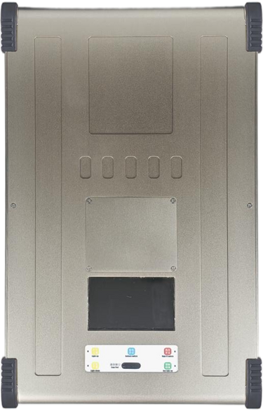
PixSurvey A2 Aerial Survey Autopilot Kit: Revolutionizing UAV Surveying for Professionals
Introduction to the PixSurvey A2 Autopilot Kit
In the world of unmanned aerial systems (UAS), the need for precise, reliable, and efficient surveying solutions has never been greater. The PixSurvey A2 Aerial Survey Autopilot Kit represents a significant advancement in UAV survey technology, providing surveyors and geospatial professionals with a powerful tool to capture accurate, high-quality data in various environments. This autopilot kit is designed for easy integration into a wide range of UAV platforms, ensuring maximum flexibility for professional applications.
Key Features of the PixSurvey A2 Autopilot Kit
1. Advanced Autopilot System
The PixSurvey A2 comes equipped with a state-of-the-art autopilot system that ensures superior flight stability and accuracy. The system integrates seamlessly with both fixed-wing and multirotor UAVs, making it a versatile solution for aerial surveying. Whether you are conducting a photogrammetric survey or collecting LiDAR data, the PixSurvey A2 guarantees reliable and precise performance.
2. RTK GPS Integration for High-Precision Surveying
One of the standout features of the PixSurvey A2 is its RTK (Real-Time Kinematic) GPS integration, which provides centimeter-level accuracy for geospatial data collection. With RTK GPS, users can capture data with an unprecedented level of precision, ensuring that your surveys meet the highest industry standards.
3. Mission Planning and Control Software
The PixSurvey A2 is compatible with advanced mission planning software, allowing users to easily plan flight paths, set survey parameters, and control the UAV remotely. The software provides real-time telemetry and data logging, making it easier to monitor the progress of your survey in the field and adjust mission parameters as necessary.
4. Long Flight Times and Payload Capacity
The PixSurvey A2 Autopilot Kit is designed to handle demanding tasks, offering long flight times to cover large survey areas efficiently. Its robust power management system ensures that UAVs can carry heavy payloads, such as high-resolution cameras, LiDAR sensors, and other surveying equipment, while maintaining stable flight performance.
5. Multispectral Imaging Support
The PixSurvey A2 is fully compatible with multispectral imaging systems, which are essential for applications like precision agriculture, vegetation mapping, and environmental monitoring. This feature expands the range of possible surveying tasks and provides users with enhanced data quality for better decision-making.
6. Real-Time Data Transmission
For real-time monitoring and analysis, the PixSurvey A2 supports real-time data transmission. This enables users to receive live updates of flight parameters, camera settings, and sensor data, which is critical for making on-the-fly adjustments and ensuring survey accuracy.
Applications of the PixSurvey A2 Autopilot Kit
1. Aerial Mapping and Photogrammetry
The PixSurvey A2 is ideal for creating high-resolution aerial maps and 3D models. Whether you are surveying a construction site, a mining operation, or a large agricultural field, this autopilot kit ensures that your UAV collects accurate data for photogrammetry applications.
2. Environmental Monitoring
Environmental monitoring requires precise, repeatable data collection, often over large areas. The PixSurvey A2’s ability to integrate with multispectral sensors and LiDAR makes it an excellent choice for tracking environmental changes, such as vegetation health, soil erosion, and wildlife habitats.
3. Precision Agriculture
Farmers and agricultural consultants can rely on the PixSurvey A2 to gather detailed data on crop health, soil composition, and irrigation patterns. The RTK GPS and multispectral imaging capabilities allow for highly accurate assessments, enabling better management practices and improved crop yields.
4. Construction and Infrastructure Surveys
For professionals in construction and infrastructure development, the PixSurvey A2 offers a powerful solution for topographic mapping, site inspection, and asset management. The system's ability to handle high-payload sensors and provide real-time data ensures that construction projects stay on track and within budget.
5. Disaster Response and Recovery
In the aftermath of a disaster, the ability to quickly assess damage and plan recovery efforts is crucial. The PixSurvey A2 allows UAVs to survey affected areas efficiently, providing first responders and recovery teams with valuable geospatial data for planning and decision-making.
Benefits of Using the PixSurvey A2 Autopilot Kit
1. Increased Efficiency and Productivity
The PixSurvey A2 enables UAVs to cover large areas in a short amount of time, reducing the need for manual survey work and allowing for faster data collection. The autopilot system’s automated flight planning and execution save time, enabling professionals to complete surveys more efficiently.
2. Cost-Effective Surveying
By integrating advanced autopilot and RTK GPS technology, the PixSurvey A2 reduces the need for expensive ground survey equipment and manual labor. This makes it a cost-effective solution for both small businesses and large enterprises in the surveying industry.
3. Improved Data Accuracy
The integration of RTK GPS ensures that the PixSurvey A2 provides high-precision data, making it an excellent choice for applications that require pinpoint accuracy. The high level of detail captured by the system results in more reliable data for decision-making and planning.
4. Seamless Integration with Existing UAVs
The PixSurvey A2 is designed to be compatible with a wide range of UAV platforms, making it easy to integrate into existing fleets. Whether you are using a fixed-wing aircraft for large-area surveys or a multirotor drone for detailed inspections, the PixSurvey A2 offers flexible, scalable solutions for a variety of use cases.
Conclusion
The PixSurvey A2 Aerial Survey Autopilot Kit is a game-changing tool for professionals in the surveying, mapping, and environmental monitoring industries. Its combination of high-precision RTK GPS, advanced autopilot capabilities, and compatibility with a variety of sensors makes it an essential tool for any UAV surveyor. Whether you are involved in construction, agriculture, or disaster recovery, the PixSurvey A2 enhances productivity, reduces costs, and improves the quality of your data.
By incorporating this advanced autopilot kit into your UAV operations, you can elevate the accuracy and efficiency of your surveys while gaining access to powerful tools that streamline mission planning and data collection.
For more information and to get started with the PixSurvey A2, visit UAV Model.


