กรองและจัดเรียง 153 ผลลัพธ์
Top Benefits of Using Drones for Land Surveying
อ่านเพิ่มเติมTop Benefits of Using Drones for Land Surveying Drones have revolutionized the field of land surveying by offering numerous advantages over traditional methods. Below are the key benefits that make...
![Makeflyeasy Hero MonitoringMakeflyeasy Hero Monitoring Aerial Survey Carrier Kit (small parts) AcUAVMODEL]()
![Makeflyeasy Hero MonitoringMakeflyeasy Hero Monitoring Aerial Survey Carrier Kit (small parts) AcUAVMODEL]()
![Makeflyeasy Hero MonitoringMakeflyeasy Hero Monitoring Aerial Survey Carrier Kit (small parts) AcUAVMODEL]()

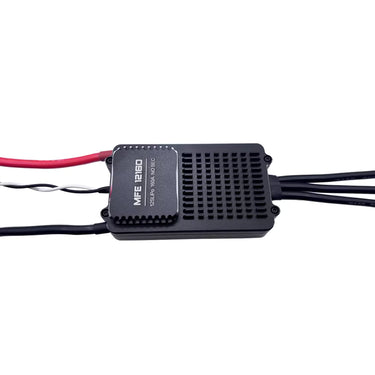
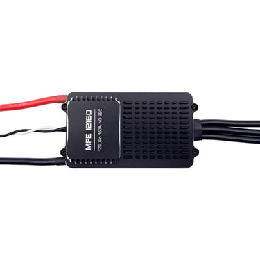
ดูอย่างรวดเร็ว ![Makeflyeasy 12S 160A ESC for aerial surveying and cruising For PIONNER only]()
![Makeflyeasy 12S 160A ESC for aerial surveying and cruising For PIONNER only]()
![Makeflyeasy 12S 160A ESC for aerial surveying and cruising For PIONNER only]()

ดูอย่างรวดเร็ว 
โดรนสำรวจและทำแผนที่ร่วมมือกับ DeepSeek: ก้าวสู่ยุคใหม่ของการสำรวจและทำแผนที่
อ่านเพิ่มเติมโดรนสำรวจและทำแผนที่ร่วมมือกับ DeepSeek: ก้าวสู่ยุคใหม่ของการสำรวจและทำแผนที่ ในยุคที่เทคโนโลยีพัฒนาอย่างรวดเร็วในปัจจุบัน อุตสาหกรรมการสำรวจและทำแผนที่กำลังเผชิญกับการเปลี่ยนแปลงอย่างลึกซึ้ง ในฐานะเครื่องมือสำรวจและทำแผนที่ที่มีประสิทธิภาพและยืดหยุ่น โดรนสำรวจและทำแผนที่ได้รับการนำไปใช้ในหลายสาขาอย่างกว้างขวาง และ DeepSeek ในฐานะผู้นำด้านปัญญาประดิษฐ์ เทคโนโลยีขั้นสูงของบริษัทได้เติมพลังใหม่ให้กับการพัฒนาโดรนสำรวจและทำแผนที่ เมื่อโดรนสำรวจและทำแผนที่ผสานกับ DeepSeek การปฏิวัติอัจฉริยะในวงการสำรวจและทำแผนที่จึงกำลังค่อยๆ เกิดขึ้นอย่างเงียบๆ โดรนสำรวจและทำแผนที่: นักบุกเบิกที่ยืดหยุ่นและมีประสิทธิภาพในงานสำรวจและทำแผนที่ โดรนสำรวจและทำแผนที่ได้เติบโตอย่างรวดเร็วในสาขาการสำรวจและทำแผนที่เนื่องจากข้อได้เปรียบต่าง ๆ เช่น ขนาดเล็ก ความยืดหยุ่น การใช้งานง่าย และต้นทุนที่ค่อนข้างต่ำ โดรนเหล่านี้สามารถเข้าถึงพื้นที่ที่ยากต่อการเข้าถึงด้วยวิธีการสำรวจและทำแผนที่แบบดั้งเดิมได้อย่างรวดเร็ว เช่น พื้นที่ภูเขาห่างไกล พื้นที่ภูมิประเทศซับซ้อน และเขตอันตราย โดยการติดตั้งกล้องความละเอียดสูง...
![12S 100A ESC for Aerial Survey Multirotor Aircraft | Makeflyeasy]()

ดูอย่างรวดเร็ว 
How UAV Fixed Wing Drones Are Transforming Land Surveying and GIS Mapping?
อ่านเพิ่มเติมLarge or linear projects, think highways, rail corridors, transmission lines, pipelines, coastal zones, demand faster coverage and consistent accuracy across big distances. A fixed wing UAV answers that need by...
![Fighter Aerial SurveyFighter Aerial Survey Carrier Kit (small parts) Accessory Kit UAVUAVMODEL]()
![Fighter Aerial SurveyFighter Aerial Survey Carrier Kit (small parts) Accessory Kit UAVUAVMODEL]()
![Fighter Aerial SurveyFighter Aerial Survey Carrier Kit (small parts) Accessory Kit UAVUAVMODEL]()

ดูอย่างรวดเร็ว ![MakeflyeasyMakeflyeasy Aerial Survey High Efficiency Electrical Factory Custom ReUAVMODEL]()
![MakeflyeasyMakeflyeasy Aerial Survey High Efficiency Electrical Factory Custom ReUAVMODEL]()
![MakeflyeasyMakeflyeasy Aerial Survey High Efficiency Electrical Factory Custom ReUAVMODEL]()

ดูอย่างรวดเร็ว 
PixSurvey A2 Aerial Survey Autopilot Kit
อ่านเพิ่มเติมPixSurvey A2 Aerial Survey Autopilot Kit: Revolutionizing UAV Surveying for Professionals Introduction to the PixSurvey A2 Autopilot Kit In the world of unmanned aerial systems (UAS), the need for precise,...
![Believer Aerial Survey Carrier Kit[MFE] Believer Aerial Survey Carrier Kit (EPO, EVA, Carbon Tube, ABS CUAVMODEL]()
![Believer Aerial Survey Carrier Kit[MFE] Believer Aerial Survey Carrier Kit (EPO, EVA, Carbon Tube, ABS CUAVMODEL]()
![Believer Aerial Survey Carrier Kit[MFE] Believer Aerial Survey Carrier Kit (EPO, EVA, Carbon Tube, ABS CUAVMODEL]()
![Believer Aerial Survey Carrier Kit[MFE] Believer Aerial Survey Carrier Kit (EPO, EVA, Carbon Tube, ABS CUAVMODEL](//www.uavmodel.com/cdn/shop/files/1_2e79ca30-9144-4132-bf81-fa7f19eff551.jpg?v=1761901798&width=20)
ดูอย่างรวดเร็ว 
การวางแผนอนาคต: ปฏิวัติการสำรวจด้วยเทคโนโลยีโดรน
อ่านเพิ่มเติมโลกของการสำรวจและทำแผนที่ได้ผ่านการเปลี่ยนแปลงครั้งใหญ่ เนื่องจากเทคโนโลยีโดรนที่เข้ามา โดรนที่มีความคล่องตัวและมุมมองที่ไม่เหมือนใคร กำลังนิยามใหม่มาตรฐานของการเก็บรวบรวมและวิเคราะห์ข้อมูลทางภูมิศาสตร์ บทบาทของโดรนในการสำรวจและทำแผนที่: การเก็บข้อมูลอย่างมีประสิทธิภาพ: โดรนสามารถครอบคลุมพื้นที่ขนาดใหญ่ได้อย่างรวดเร็วและมีประสิทธิภาพ โดยเก็บภาพความละเอียดสูงที่จำเป็นสำหรับแผนที่และแบบจำลองที่ละเอียด ความแม่นยำและความเที่ยงตรง: ติดตั้งด้วยเซ็นเซอร์ขั้นสูงและเทคโนโลยี GPS โดรนให้ข้อมูลที่มีความแม่นยำสูง ซึ่งมีความสำคัญสำหรับการสำรวจภูมิประเทศ การวางแผนก่อสร้าง และการประยุกต์ใช้ GIS ประหยัดต้นทุนและประหยัดเวลา: วิธีการสำรวจแบบดั้งเดิมมักใช้เวลานานและมีค่าใช้จ่ายสูง โดรนช่วยทำให้กระบวนการรวดเร็วขึ้นและประหยัดต้นทุนมากขึ้น การประยุกต์ใช้ขั้นสูงในสาขาต่าง ๆ: การวางผังเมืองและการพัฒนา: โดรนมีบทบาทสำคัญในการวางผังเมือง โดยให้ข้อมูลเชิงลึกที่ละเอียดเกี่ยวกับการใช้ที่ดิน โครงสร้างพื้นฐาน และทัศนียภาพของเมือง การศึกษาสิ่งแวดล้อม: นักนิเวศวิทยาและนักวิทยาศาสตร์สิ่งแวดล้อมใช้โดรนในการเฝ้าติดตามระบบนิเวศ...

ดูอย่างรวดเร็ว 
ในสภาพแวดล้อมที่ซับซ้อนและเปลี่ยนแปลงอยู่เสมอ Z3015 โดดเด่นในฐานะพันธมิตรที่เชื่อถือได้สำหรับการถ่ายภาพทางอากาศระดับมืออาชีพ การสำรวจ และการตรวจสอบ ด้วยความทนทานที่ยาวนานเป็นพิเศษและความต้านทานลมที่ยอดเยี่ยม
อ่านเพิ่มเติมในสภาพแวดล้อมที่ซับซ้อนและเปลี่ยนแปลงอยู่ตลอดเวลา, theZ3015โดดเด่นในฐานะพันธมิตรที่เชื่อถือได้สำหรับการถ่ายภาพทางอากาศระดับมืออาชีพ การสำรวจ และการตรวจสอบ ด้วยความทนทานเป็นเวลานานเป็นพิเศษและความต้านทานลมที่ยอดเยี่ยม ด้วยความกว้างปีก 3000 มม. น้ำหนักเปล่า 6 กก. น้ำหนักขึ้นบิน 12–16 กก. และความสามารถในการบรรทุก 0.5–2.5 กก. Z3015 มีความสามารถในการบินได้นาน 6–10 ชั่วโมง พร้อมน้ำหนักบรรทุก 1 กิโลกรัม โดยสามารถบินได้ระยะทาง 400–600 กิโลเมตรต่อเที่ยวบิน ความเร็วในการล่องเรือที่ประหยัดของมันอยู่ในช่วง 15 ถึง...
Skywalker X8 2122mm UAV Fixed Wing Drone: The Ultimate Long-Range FPV and Survey Platform
อ่านเพิ่มเติมSkywalker X8 2122mm UAV Fixed Wing Drone: The Ultimate Long-Range FPV and Survey Platform In the rapidly evolving world of unmanned aerial vehicles, fixed-wing drones continue to dominate long-range and...

AirBrain A3PRO — Dedicated Flight Control System for Aerial Survey & AOPA Training
อ่านเพิ่มเติมAirBrain A3PRO — Dedicated Flight Control System for Aerial Survey & AOPA Training Professional flight controller for aerial survey, photogrammetry, and pilot training — industrial grade, multi-sensor redundancy, cross-wrap flight...

Why Fixed Wing Drones Are the Best Choice for Long-Range Aerial Surveys in the USA?
อ่านเพิ่มเติมAcross industries like agriculture, mining, energy, and infrastructure, the demand for accurate and cost-effective aerial surveys is growing quickly. From massive farmlands in the Midwest to sprawling oil pipelines in...
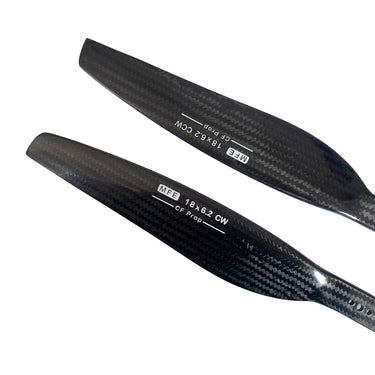
![Makeflyeasy Carbon fiberMakeflyeasy Carbon fiber composite propeller 1862 dynamic balance caliUAVMODEL]()
![Makeflyeasy Carbon fiberMakeflyeasy Carbon fiber composite propeller 1862 dynamic balance caliUAVMODEL]()
![Makeflyeasy Carbon fiberMakeflyeasy Carbon fiber composite propeller 1862 dynamic balance caliUAVMODEL]()

ดูอย่างรวดเร็ว ![Makeflyeasy Pioneer Aerial Survey Aircraft Kit Small Parts]()
![Makeflyeasy Pioneer Aerial Survey Aircraft Kit Small Parts]()
![Makeflyeasy Pioneer Aerial Survey Aircraft Kit Small Parts]()

ดูอย่างรวดเร็ว ![Makeflyeasy UAVMakeflyeasy UAV aerial survey PIXHAWK camera shutter cableUAVMODEL]()

ดูอย่างรวดเร็ว ![Makeflyeasy Hero MonitoringMakeflyeasy Hero Monitoring Aerial Survey Carrier KIT (EPO, EVA, CarboUAVMODEL]()
![Makeflyeasy Hero MonitoringMakeflyeasy Hero Monitoring Aerial Survey Carrier KIT (EPO, EVA, CarboUAVMODEL]()
![Makeflyeasy Hero MonitoringMakeflyeasy Hero Monitoring Aerial Survey Carrier KIT (EPO, EVA, CarboUAVMODEL]()

ดูอย่างรวดเร็ว 
การเพิ่มประสิทธิภาพการสำรวจธรณีฟิสิกส์ผ่านการสำรวจแผ่นดินไหวด้วยเทคโนโลยีโดรนขั้นสูง
อ่านเพิ่มเติมการวิเคราะห์เชิงลึกและข้อมูลเชิงเทคนิคเกี่ยวกับวิธีการสำรวจแผ่นดินไหวและการประยุกต์ใช้งาน
![MAD 5X 5010MAD 5X 5010 PROPULSION COMBO for the long-range inspection drone mappiUAVMODEL]()
![MAD 5X 5010MAD 5X 5010 PROPULSION COMBO for the long-range inspection drone mappiUAVMODEL]()
![MAD 5X 5010MAD 5X 5010 PROPULSION COMBO for the long-range inspection drone mappiUAVMODEL]()

ดูอย่างรวดเร็ว ![Makeflyeasy Aerial surveyMakeflyeasy Aerial survey high efficiency motor Struggler VTOL rotor mUAVMODEL]()
![Makeflyeasy Aerial surveyMakeflyeasy Aerial survey high efficiency motor Struggler VTOL rotor mUAVMODEL]()
![Makeflyeasy Aerial surveyMakeflyeasy Aerial survey high efficiency motor Struggler VTOL rotor mUAVMODEL]()

ดูอย่างรวดเร็ว


![Believer Aerial Survey Carrier Kit[MFE] Believer Aerial Survey Carrier Kit (EPO, EVA, Carbon Tube, ABS CUAVMODEL](http://www.uavmodel.com/cdn/shop/files/2_cd469d79-3577-4867-b2d9-a84659f76a2d.jpg?v=1761901798&width=375)
![Believer Aerial Survey Carrier Kit[MFE] Believer Aerial Survey Carrier Kit (EPO, EVA, Carbon Tube, ABS CUAVMODEL](http://www.uavmodel.com/cdn/shop/files/3_3919a81b-097c-4d5a-858a-5159f0c2ce95.jpg?v=1761901797&width=375)
![Believer Aerial Survey Carrier Kit[MFE] Believer Aerial Survey Carrier Kit (EPO, EVA, Carbon Tube, ABS CUAVMODEL](http://www.uavmodel.com/cdn/shop/files/4_b8948031-e19f-476c-be58-45b9df8defb2.jpg?v=1761901797&width=375)
![Believer Aerial Survey Carrier Kit[MFE] Believer Aerial Survey Carrier Kit (EPO, EVA, Carbon Tube, ABS CUAVMODEL](http://www.uavmodel.com/cdn/shop/files/1_2e79ca30-9144-4132-bf81-fa7f19eff551.jpg?v=1761901798&width=20)