กรองและจัดเรียง 138 ผลลัพธ์
![Makeflyeasy Hero MonitoringMakeflyeasy Hero Monitoring Aerial Survey Carrier Kit (small parts) AcUAVMODEL]()
![Makeflyeasy Hero MonitoringMakeflyeasy Hero Monitoring Aerial Survey Carrier Kit (small parts) AcUAVMODEL]()
![Makeflyeasy Hero MonitoringMakeflyeasy Hero Monitoring Aerial Survey Carrier Kit (small parts) AcUAVMODEL]()

ดูอย่างรวดเร็ว ![Fighter Aerial SurveyFighter Aerial Survey Carrier Kit (small parts) Accessory Kit UAVUAVMODEL]()
![Fighter Aerial SurveyFighter Aerial Survey Carrier Kit (small parts) Accessory Kit UAVUAVMODEL]()
![Fighter Aerial SurveyFighter Aerial Survey Carrier Kit (small parts) Accessory Kit UAVUAVMODEL]()

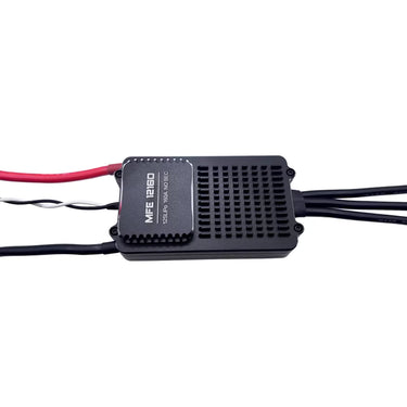
ดูอย่างรวดเร็ว ![12S 100A ESC for Aerial Survey Multirotor Aircraft | Makeflyeasy]()

ดูอย่างรวดเร็ว ![MakeflyeasyMakeflyeasy Aerial Survey High Efficiency Electrical Factory Custom ReUAVMODEL]()
![MakeflyeasyMakeflyeasy Aerial Survey High Efficiency Electrical Factory Custom ReUAVMODEL]()
![MakeflyeasyMakeflyeasy Aerial Survey High Efficiency Electrical Factory Custom ReUAVMODEL]()

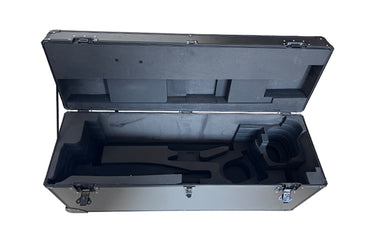
ดูอย่างรวดเร็ว ![Believer Aerial Survey Carrier Kit[MFE] Believer Aerial Survey Carrier Kit (EPO, EVA, Carbon Tube, ABS CUAVMODEL]()
![Believer Aerial Survey Carrier Kit[MFE] Believer Aerial Survey Carrier Kit (EPO, EVA, Carbon Tube, ABS CUAVMODEL]()
![Believer Aerial Survey Carrier Kit[MFE] Believer Aerial Survey Carrier Kit (EPO, EVA, Carbon Tube, ABS CUAVMODEL]()
![Believer Aerial Survey Carrier Kit[MFE] Believer Aerial Survey Carrier Kit (EPO, EVA, Carbon Tube, ABS CUAVMODEL](//www.uavmodel.com/cdn/shop/files/1_2e79ca30-9144-4132-bf81-fa7f19eff551.jpg?v=1761901798&width=20)
ดูอย่างรวดเร็ว 
PixSurvey A2 Aerial Survey Autopilot Kit
อ่านเพิ่มเติมPixSurvey A2 Aerial Survey Autopilot Kit: Revolutionizing UAV Surveying for Professionals Introduction to the PixSurvey A2 Autopilot Kit In the world of unmanned aerial systems (UAS), the need for precise,...

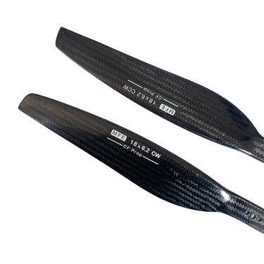
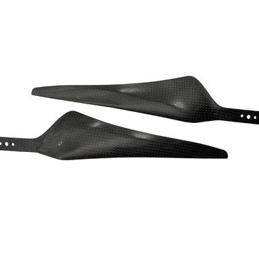
ดูอย่างรวดเร็ว ![Makeflyeasy Carbon fiberMakeflyeasy Carbon fiber composite propeller 1862 dynamic balance caliUAVMODEL]()
![Makeflyeasy Carbon fiberMakeflyeasy Carbon fiber composite propeller 1862 dynamic balance caliUAVMODEL]()
![Makeflyeasy Carbon fiberMakeflyeasy Carbon fiber composite propeller 1862 dynamic balance caliUAVMODEL]()

ดูอย่างรวดเร็ว ![Makeflyeasy UAVMakeflyeasy UAV aerial survey PIXHAWK camera shutter cableUAVMODEL]()

ดูอย่างรวดเร็ว ![Makeflyeasy Pioneer Aerial Survey Aircraft Kit Small Parts]()
![Makeflyeasy Pioneer Aerial Survey Aircraft Kit Small Parts]()
![Makeflyeasy Pioneer Aerial Survey Aircraft Kit Small Parts]()

ดูอย่างรวดเร็ว 
AirBrain A3PRO — Dedicated Flight Control System for Aerial Survey & AOPA Training
อ่านเพิ่มเติมAirBrain A3PRO — Dedicated Flight Control System for Aerial Survey & AOPA Training Professional flight controller for aerial survey, photogrammetry, and pilot training — industrial grade, multi-sensor redundancy, cross-wrap flight...
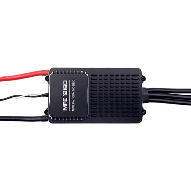
![Makeflyeasy 12S 160A ESC for aerial surveying and cruising For PIONNER only]()
![Makeflyeasy 12S 160A ESC for aerial surveying and cruising For PIONNER only]()
![Makeflyeasy 12S 160A ESC for aerial surveying and cruising For PIONNER only]()

ดูอย่างรวดเร็ว Skywalker X8 2122mm UAV Fixed Wing Drone: The Ultimate Long-Range FPV and Survey Platform
อ่านเพิ่มเติมSkywalker X8 2122mm UAV Fixed Wing Drone: The Ultimate Long-Range FPV and Survey Platform In the rapidly evolving world of unmanned aerial vehicles, fixed-wing drones continue to dominate long-range and...

Why Fixed Wing Drones Are the Best Choice for Long-Range Aerial Surveys in the USA?
อ่านเพิ่มเติมAcross industries like agriculture, mining, energy, and infrastructure, the demand for accurate and cost-effective aerial surveys is growing quickly. From massive farmlands in the Midwest to sprawling oil pipelines in...
![Makeflyeasy Hero MonitoringMakeflyeasy Hero Monitoring Aerial Survey Carrier KIT (EPO, EVA, CarboUAVMODEL]()
![Makeflyeasy Hero MonitoringMakeflyeasy Hero Monitoring Aerial Survey Carrier KIT (EPO, EVA, CarboUAVMODEL]()
![Makeflyeasy Hero MonitoringMakeflyeasy Hero Monitoring Aerial Survey Carrier KIT (EPO, EVA, CarboUAVMODEL]()

ดูอย่างรวดเร็ว Unmanned Aerial Vehicle (UAV) Technology: A Comprehensive Guide
อ่านเพิ่มเติมUnmanned Aerial Vehicle (UAV) Technology: A Comprehensive Guide Unmanned Aerial Vehicles (UAVs), commonly known as drones, represent one of the fastest growing sectors in modern aerospace technology. From hobby grade...

การทำแผนที่ด้วยยานพาหนะไร้คนขับ: การใช้งานและข้อดี
อ่านเพิ่มเติมการทำแผนที่ด้วยโดรน UAV ถูกนำมาใช้ในรูปแบบใดบ้าง? จำนวนไซต์ก่อสร้างที่หันมาใช้การทำแผนที่ด้วยโดรนเพื่อเพิ่มความเร็ว คุณภาพ และประสิทธิภาพกำลังเพิ่มขึ้นอย่างต่อเนื่อง ตามรายงานโดยอัลไลด์ มาร์เก็ต รีเสิร์ชอุตสาหกรรมโดรนก่อสร้างคาดว่าจะมีมูลค่าใกล้เคียง 12 พันล้านดอลลาร์ภายในปี 2027 แม้จะมีการเติบโต แต่การทำแผนที่ด้วยโดรนยังคงเป็นเครื่องมือที่ค่อนข้างใหม่สำหรับผู้รับเหมาและผู้สำรวจหลายราย ซึ่งเรียกอีกอย่างว่าการสำรวจทางอากาศ การทำแผนที่ด้วยโดรนหมายถึงการถ่ายภาพจากมุมสูงและใช้ซอฟต์แวร์เฉพาะทางในการต่อภาพเหล่านั้นเข้าด้วยกันเป็นภาพสามมิติของสถานที่ทำงาน ถ้าคุณไม่แน่ใจว่าจะทำอย่างไรUAVฟังก์ชันการทำแผนที่ด้วยโดรนหรือข้อได้เปรียบที่โดรนมอบให้นั้น ไม่ต้องกังวล—เราจะสรุปการใช้งานและอธิบายว่าโดรนสามารถช่วยคุณในการทำแผนที่และวัดพื้นที่ไซต์งานของคุณได้อย่างไร การทำแผนที่ด้วยโดรนคืออะไร? ก่อนที่จะสำรวจการใช้งานต่าง ๆ ของการทำแผนที่ด้วยโดรน สิ่งสำคัญคือต้องเริ่มต้นด้วยภาพรวมพื้นฐานของกระบวนการ: โฟโตแกรมเมตรี โฟโตแกรมเมตรีเป็นศาสตร์ในการสกัดข้อมูลทางกายภาพจากภาพสองมิติ โดยมักเป็นภาพถ่ายทางอากาศที่ถ่ายโดยโดรน โดยการรวมภาพที่ซ้อนทับกันและมีการติดแท็กตำแหน่งทางภูมิศาสตร์ของคุณลักษณะเดียวกันจากมุมมองที่แตกต่างกัน ซอฟต์แวร์โฟโตแกรมเมทรีจะสร้างแบบจำลอง 3 มิติที่เหมือนจริงของพื้นผิวภูมิประเทศ...
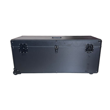
![HERO Aerial Survey DroneMakeflyeasy HERO Aerial Survey Drone Transport Case Portable Case OtheUAVMODEL]()
![HERO Aerial Survey DroneMakeflyeasy HERO Aerial Survey Drone Transport Case Portable Case OtheUAVMODEL]()
![HERO Aerial Survey DroneMakeflyeasy HERO Aerial Survey Drone Transport Case Portable Case OtheUAVMODEL]()

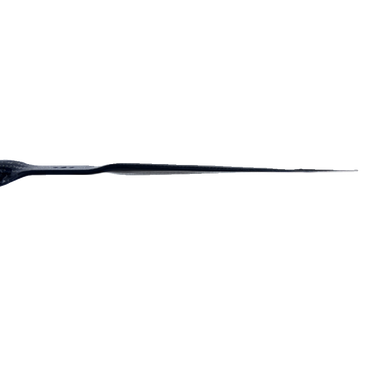
ดูอย่างรวดเร็ว ![Makeflyeasy 17*55 carbon fiber propellerMakeflyeasy 17*55 1755 Carbon Fiber Propeller Aerial Survey UAV ForwarUAVMODEL]()
![Makeflyeasy 17*55 carbon fiber propellerMakeflyeasy 17*55 1755 Carbon Fiber Propeller Aerial Survey UAV ForwarUAVMODEL]()

ดูอย่างรวดเร็ว ![Makeflyeasy Aerial surveyMakeflyeasy Aerial survey high-efficiency motor Customized Struggler VUAVMODEL]()

ดูอย่างรวดเร็ว ![Makeflyeasy Aerial surveyMakeflyeasy Aerial survey high efficiency motor Struggler VTOL rotor mUAVMODEL]()
![Makeflyeasy Aerial surveyMakeflyeasy Aerial survey high efficiency motor Struggler VTOL rotor mUAVMODEL]()
![Makeflyeasy Aerial surveyMakeflyeasy Aerial survey high efficiency motor Struggler VTOL rotor mUAVMODEL]()

ดูอย่างรวดเร็ว 
โดรนสำรวจและทำแผนที่ร่วมมือกับ DeepSeek: ก้าวสู่ยุคใหม่ของการสำรวจและทำแผนที่
อ่านเพิ่มเติมโดรนสำรวจและทำแผนที่ร่วมมือกับ DeepSeek: ก้าวสู่ยุคใหม่ของการสำรวจและทำแผนที่ ในยุคที่เทคโนโลยีพัฒนาอย่างรวดเร็วในปัจจุบัน อุตสาหกรรมการสำรวจและทำแผนที่กำลังเผชิญกับการเปลี่ยนแปลงอย่างลึกซึ้ง ในฐานะเครื่องมือสำรวจและทำแผนที่ที่มีประสิทธิภาพและยืดหยุ่น โดรนสำรวจและทำแผนที่ได้รับการนำไปใช้ในหลายสาขาอย่างกว้างขวาง และ DeepSeek ในฐานะผู้นำด้านปัญญาประดิษฐ์ เทคโนโลยีขั้นสูงของบริษัทได้เติมพลังใหม่ให้กับการพัฒนาโดรนสำรวจและทำแผนที่ เมื่อโดรนสำรวจและทำแผนที่ผสานกับ DeepSeek การปฏิวัติอัจฉริยะในวงการสำรวจและทำแผนที่จึงกำลังค่อยๆ เกิดขึ้นอย่างเงียบๆ โดรนสำรวจและทำแผนที่: นักบุกเบิกที่ยืดหยุ่นและมีประสิทธิภาพในงานสำรวจและทำแผนที่ โดรนสำรวจและทำแผนที่ได้เติบโตอย่างรวดเร็วในสาขาการสำรวจและทำแผนที่เนื่องจากข้อได้เปรียบต่าง ๆ เช่น ขนาดเล็ก ความยืดหยุ่น การใช้งานง่าย และต้นทุนที่ค่อนข้างต่ำ โดรนเหล่านี้สามารถเข้าถึงพื้นที่ที่ยากต่อการเข้าถึงด้วยวิธีการสำรวจและทำแผนที่แบบดั้งเดิมได้อย่างรวดเร็ว เช่น พื้นที่ภูเขาห่างไกล พื้นที่ภูมิประเทศซับซ้อน และเขตอันตราย โดยการติดตั้งกล้องความละเอียดสูง...

How UAV Fixed Wing Drones Are Transforming Land Surveying and GIS Mapping?
อ่านเพิ่มเติมLarge or linear projects, think highways, rail corridors, transmission lines, pipelines, coastal zones, demand faster coverage and consistent accuracy across big distances. A fixed wing UAV answers that need by...


![Believer Aerial Survey Carrier Kit[MFE] Believer Aerial Survey Carrier Kit (EPO, EVA, Carbon Tube, ABS CUAVMODEL](http://www.uavmodel.com/cdn/shop/files/2_cd469d79-3577-4867-b2d9-a84659f76a2d.jpg?v=1761901798&width=375)
![Believer Aerial Survey Carrier Kit[MFE] Believer Aerial Survey Carrier Kit (EPO, EVA, Carbon Tube, ABS CUAVMODEL](http://www.uavmodel.com/cdn/shop/files/3_3919a81b-097c-4d5a-858a-5159f0c2ce95.jpg?v=1761901797&width=375)
![Believer Aerial Survey Carrier Kit[MFE] Believer Aerial Survey Carrier Kit (EPO, EVA, Carbon Tube, ABS CUAVMODEL](http://www.uavmodel.com/cdn/shop/files/4_b8948031-e19f-476c-be58-45b9df8defb2.jpg?v=1761901797&width=375)
![Believer Aerial Survey Carrier Kit[MFE] Believer Aerial Survey Carrier Kit (EPO, EVA, Carbon Tube, ABS CUAVMODEL](http://www.uavmodel.com/cdn/shop/files/1_2e79ca30-9144-4132-bf81-fa7f19eff551.jpg?v=1761901798&width=20)