Filtrer et trier 68 résultats
Skywalker SKY245 UAV VTOL: Long-Endurance Fixed-Wing Drone for Professional Mapping
Lire la suiteSkywalker SKY245 UAV VTOL: Long-Endurance Fixed-Wing Drone for Professional Mapping The Skywalker SKY245 UAV VTOL is a next-generation hybrid drone designed for long-endurance missions, combining vertical takeoff capability with fixed-wing...

How UAV Fixed Wing Drones Are Transforming Land Surveying and GIS Mapping?
Lire la suiteLarge or linear projects, think highways, rail corridors, transmission lines, pipelines, coastal zones, demand faster coverage and consistent accuracy across big distances. A fixed wing UAV answers that need by...
![Slamtec RPLIDAR S1Slamtec RPLIDAR S1 TOF Ranging Method 40 Meters Range Radius Outdoor AUAVMODEL]()
![Slamtec RPLIDAR S1Slamtec RPLIDAR S1 TOF Ranging Method 40 Meters Range Radius Outdoor AUAVMODEL]()
![Slamtec RPLIDAR S1Slamtec RPLIDAR S1 TOF Ranging Method 40 Meters Range Radius Outdoor AUAVMODEL]()

Aperçu rapide 
Façons de gagner de l'argent avec la cartographie par drone
Lire la suite**Façons de Gagner de l'Argent avec la Cartographie par Drone**Ces dernières années, la cartographie par drone est devenue un domaine lucratif et innovant. Avec les avancées de la technologie des...

Cartographie par drone dans l'inspection des lignes électriques et des pipelines
Lire la suite**Cartographie par drone dans l'inspection des lignes électriques et des pipelines**Dans le paysage technologique en évolution rapide d'aujourd'hui, la cartographie par drone est devenue un outil révolutionnaire dans l'inspection des...

Surveying and Mapping Drones Join Hands with DeepSeek: Ushering in a New Era of Surveying and Mapping
Lire la suiteSurveying and Mapping Drones Join Hands with DeepSeek: Ushering in a New Era of Surveying and Mapping In the era of rapid technological development today, the surveying and mapping industry...
Makeflyeasy Pioneer 3200mm VTOL UAV: A Long-Endurance Fixed-Wing Drone for Mapping, Inspection, and Industrial Operations
Lire la suiteMakeflyeasy Pioneer 3200mm VTOL UAV: A Long-Endurance Fixed-Wing Drone for Mapping, Inspection, and Industrial Operations The rapid evolution of unmanned aerial vehicles (UAVs) has transformed industries such as surveying, agriculture,...

Cartographier l'avenir : Révolutionner l'arpentage avec la technologie des drones
Lire la suiteLe monde de l'arpentage et de la cartographie a subi une transformation significative, grâce à l'avènement de la technologie des drones. Les drones, avec leur agilité et leur perspective inégalées,...

Comment les drones à décollage et atterrissage verticaux (VTOL) peuvent générer des profits dans le domaine de la cartographie
Lire la suiteComment les drones à décollage et atterrissage verticaux (VTOL) peuvent générer des profits dans le domaine de la cartographie Ces dernières années, les drones à décollage et atterrissage verticaux (VTOL)...
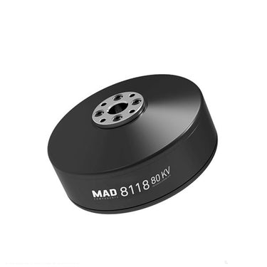
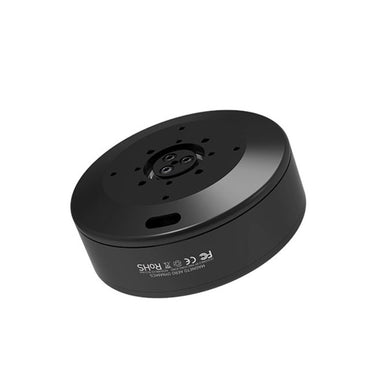
![MAD 8118 IPE V1.0MAD 8118 IPE KV80 KV100 huge Motor For RC Quadcopter NSK bearing BrushUAVMODEL]()
![MAD 8118 IPE V1.0MAD 8118 IPE KV80 KV100 huge Motor For RC Quadcopter NSK bearing BrushUAVMODEL]()
![MAD 8118 IPE V1.0MAD 8118 IPE KV80 KV100 huge Motor For RC Quadcopter NSK bearing BrushUAVMODEL]()

Aperçu rapide MAD 8118 IPE KV80 KV100 moteur énorme pour quadricoptère RC roulement NSK moteur sans balais utilisé dans l'irrigation agricole, la cartographie $254.00 /80KV100KVDisponible en 2 couleursComprehensive Guide to UAV Technology: Applications, Innovations and Industry Trends
Lire la suiteComprehensive Guide to UAV Technology: Applications, Innovations and Industry Trends UAV technology, short for Unmanned Aerial Vehicle technology, refers to advanced aerial systems that operate without an onboard pilot. These...
The Ultimate Guide to Drone Electronics: Powering Modern UAV Performance
Lire la suiteThe Ultimate Guide to Drone Electronics: Powering Modern UAV Performance Unmanned Aerial Vehicles (UAVs), commonly known as drones, are transforming industries such as agriculture, mapping, infrastructure inspection, logistics, and security....
The Ultimate Guide to Professional UAV Drones and Components (2026 Edition)
Lire la suiteThe Ultimate Guide to Professional UAV Drones and Components (2026 Edition) Unmanned Aerial Vehicles (UAVs), commonly known as drones, are transforming industries worldwide. From aerial mapping to precision agriculture, modern...

Enhancing Geophysical Exploration through Seismic Survey with Advanced Drone Technology
Lire la suiteIn-Depth Analysis and Technical Insights on Seismic Survey Methods and Their Applications

Makeflyeasy Pioneer 3200mm VTOL Fixed Wing UAV Drone
Lire la suiteMakeflyeasy Pioneer 3200mm VTOL Fixed Wing UAV Drone – High-End Hybrid Drone for Professional Aerial Missions The Makeflyeasy Pioneer 3200mm VTOL Fixed Wing UAV Drone is a professional-grade hybrid unmanned...
The Ultimate Guide to UAV Drones: Technology, Components, and Industrial Applications
Lire la suiteThe Ultimate Guide to UAV Drones: Technology, Components, and Industrial Applications Introduction Unmanned Aerial Vehicles (UAVs), commonly called drones, have transformed modern technology and industry. Over the past decade, UAV...

AirBrain A3PRO — Dedicated Flight Control System for Aerial Survey & AOPA Training
Lire la suiteAirBrain A3PRO — Dedicated Flight Control System for Aerial Survey & AOPA Training Professional flight controller for aerial survey, photogrammetry, and pilot training — industrial grade, multi-sensor redundancy, cross-wrap flight...
Skywalker X8 2122mm UAV Fixed Wing Drone: The Ultimate Long-Range FPV and Survey Platform
Lire la suiteSkywalker X8 2122mm UAV Fixed Wing Drone: The Ultimate Long-Range FPV and Survey Platform In the rapidly evolving world of unmanned aerial vehicles, fixed-wing drones continue to dominate long-range and...
The Complete Guide to UAV Technology and Modern Drone Systems
Lire la suiteThe Complete Guide to UAV Technology and Modern Drone Systems An Unmanned Aerial Vehicle (UAV), commonly known as a drone, is an aircraft that operates without an onboard human pilot....

Intelligence Artificielle (IA) dans la Technologie des Drones : Amélioration de l'Autonomie et de la Prise de Décision
Lire la suiteL'intelligence artificielle (IA) est devenue un élément révolutionnaire dans l'industrie des drones, offrant aux drones la capacité d'analyser des données, de prendre des décisions et d'exécuter des tâches complexes de...
Unmanned Aerial Vehicle (UAV) Technology: A Comprehensive Guide
Lire la suiteUnmanned Aerial Vehicle (UAV) Technology: A Comprehensive Guide Unmanned Aerial Vehicles (UAVs), commonly known as drones, represent one of the fastest growing sectors in modern aerospace technology. From hobby grade...
Advanced UAV Technology: How Modern Drones Are Transforming Global Industries
Lire la suiteAdvanced UAV Technology: How Modern Drones Are Transforming Global Industries Unmanned Aerial Vehicle technology, commonly known as UAV or drone technology, has rapidly evolved into a critical tool for industrial...