絞り込み・並べ替え 68件
Skywalker SKY245 UAV VTOL: Long-Endurance Fixed-Wing Drone for Professional Mapping
続きを読むSkywalker SKY245 UAV VTOL: Long-Endurance Fixed-Wing Drone for Professional Mapping The Skywalker SKY245 UAV VTOL is a next-generation hybrid drone designed for long-endurance missions, combining vertical takeoff capability with fixed-wing...

How UAV Fixed Wing Drones Are Transforming Land Surveying and GIS Mapping?
続きを読むLarge or linear projects, think highways, rail corridors, transmission lines, pipelines, coastal zones, demand faster coverage and consistent accuracy across big distances. A fixed wing UAV answers that need by...
![Slamtec RPLIDAR S1Slamtec RPLIDAR S1 TOF Ranging Method 40 Meters Range Radius Outdoor AUAVMODEL]()
![Slamtec RPLIDAR S1Slamtec RPLIDAR S1 TOF Ranging Method 40 Meters Range Radius Outdoor AUAVMODEL]()
![Slamtec RPLIDAR S1Slamtec RPLIDAR S1 TOF Ranging Method 40 Meters Range Radius Outdoor AUAVMODEL]()

クイックビュー 
Ways to Make Money with Drone Mapping
続きを読む**Ways to Make Money with Drone Mapping**In recent years, drone mapping has emerged as a lucrative and innovative field. With the advancements in drone technology and the growing demand for...

Drone Mapping in Power Line and Pipeline Inspection
続きを読む**Drone Mapping in Power Line and Pipeline Inspection**In today's rapidly evolving technological landscape, drone mapping has emerged as a game-changing tool in the inspection of power lines and pipelines. This...

Surveying and Mapping Drones Join Hands with DeepSeek: Ushering in a New Era of Surveying and Mapping
続きを読むSurveying and Mapping Drones Join Hands with DeepSeek: Ushering in a New Era of Surveying and Mapping In the era of rapid technological development today, the surveying and mapping industry...
Makeflyeasy Pioneer 3200mm VTOL UAV: A Long-Endurance Fixed-Wing Drone for Mapping, Inspection, and Industrial Operations
続きを読むMakeflyeasy Pioneer 3200mm VTOL UAV: A Long-Endurance Fixed-Wing Drone for Mapping, Inspection, and Industrial Operations The rapid evolution of unmanned aerial vehicles (UAVs) has transformed industries such as surveying, agriculture,...

未来を描く:ドローン技術による測量の革命
続きを読む測量と地図作成の世界は、ドローン技術の登場により大きな変革を遂げました。ドローンは、その比類のない機動性と視点を持ち、地理データの収集と分析の基準を再定義しています。 ドローンの測量とマッピングにおける役割: 効率的なデータ収集:ドローンは広大な土地を迅速かつ効率的にカバーし、詳細な地図やモデルに不可欠な高解像度の画像を収集します。 精度と正確性:高度なセンサーとGPS技術を備えたドローンは、地形調査、建設計画、GISアプリケーションに不可欠な非常に正確なデータを提供します。 コスト効率が良く、時間を節約: 従来の測量方法はしばしば時間がかかり、高価です。ドローンはプロセスを効率化し、より迅速でコスト効果の高いものにします。 さまざまな分野における高度な応用: 都市計画と開発:ドローンは都市計画において重要な役割を果たし、土地利用、インフラ、都市景観に関する詳細な洞察を提供します。 環境学:生態学者や環境科学者は、ドローンを使用して生態系を監視し、生息地を評価し、環境の変化を追跡します。 農業:精密農業は、土地評価、作物健康モニタリング、資源管理のためにドローンデータを活用します。 テクノロジーの優位性: 3Dモデリングとフォトグラメトリー:フォトグラメトリーソフトウェアを搭載したドローンは、風景や構造物の詳細な3Dモデルを作成でき、建築家、エンジニア、開発者にとって貴重です。 リアルタイムデータと分析:データをリアルタイムで送信する能力は、動的な環境において重要な即時分析と意思決定を可能にします。 課題と将来の展望: ドローン技術は測量に多くの利点を提供しますが、空域規制、データプライバシー、バッテリー寿命の制限といった課題も依然として存在します。しかし、技術が進歩するにつれて、ドローンは測量やマッピングにおいてさらに重要な役割を果たすことが期待されており、かつては実現不可能と見なされていた可能性を提供しています。 Conclusion: ドローンは私たちの世界の見方を変えるだけでなく、それを地図化する方法も変えています。この技術が進化し続ける中、測量と地図作成における革新の可能性は無限であり、正確さと効率が標準となる未来を約束しています。 最後の考え: 測量および地図作成の専門家にとって、ドローン技術を取り入れることは時代に遅れないためだけではなく、新たな可能性を開き、画期的な発見への道を切り開くことです。

How Vertical Takeoff and Landing (VTOL) Drones Can Generate Profits in the Mapping Field
続きを読むHow Vertical Takeoff and Landing (VTOL) Drones Can Generate Profits in the Mapping Field In recent years, vertical takeoff and landing (VTOL) drones have emerged as a revolutionary technology in...
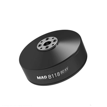
![MAD 8118 IPE V1.0MAD 8118 IPE KV80 KV100 huge Motor For RC Quadcopter NSK bearing BrushUAVMODEL]()
![MAD 8118 IPE V1.0MAD 8118 IPE KV80 KV100 huge Motor For RC Quadcopter NSK bearing BrushUAVMODEL]()
![MAD 8118 IPE V1.0MAD 8118 IPE KV80 KV100 huge Motor For RC Quadcopter NSK bearing BrushUAVMODEL]()

クイックビュー Comprehensive Guide to UAV Technology: Applications, Innovations and Industry Trends
続きを読むComprehensive Guide to UAV Technology: Applications, Innovations and Industry Trends UAV technology, short for Unmanned Aerial Vehicle technology, refers to advanced aerial systems that operate without an onboard pilot. These...
The Ultimate Guide to Drone Electronics: Powering Modern UAV Performance
続きを読むThe Ultimate Guide to Drone Electronics: Powering Modern UAV Performance Unmanned Aerial Vehicles (UAVs), commonly known as drones, are transforming industries such as agriculture, mapping, infrastructure inspection, logistics, and security....
The Ultimate Guide to Professional UAV Drones and Components (2026 Edition)
続きを読むThe Ultimate Guide to Professional UAV Drones and Components (2026 Edition) Unmanned Aerial Vehicles (UAVs), commonly known as drones, are transforming industries worldwide. From aerial mapping to precision agriculture, modern...

Enhancing Geophysical Exploration through Seismic Survey with Advanced Drone Technology
続きを読むIn-Depth Analysis and Technical Insights on Seismic Survey Methods and Their Applications

Makeflyeasy Pioneer 3200mm VTOL Fixed Wing UAV Drone
続きを読むMakeflyeasy Pioneer 3200mm VTOL Fixed Wing UAV Drone – High-End Hybrid Drone for Professional Aerial Missions The Makeflyeasy Pioneer 3200mm VTOL Fixed Wing UAV Drone is a professional-grade hybrid unmanned...
The Ultimate Guide to UAV Drones: Technology, Components, and Industrial Applications
続きを読むThe Ultimate Guide to UAV Drones: Technology, Components, and Industrial Applications Introduction Unmanned Aerial Vehicles (UAVs), commonly called drones, have transformed modern technology and industry. Over the past decade, UAV...

AirBrain A3PRO — Dedicated Flight Control System for Aerial Survey & AOPA Training
続きを読むAirBrain A3PRO — Dedicated Flight Control System for Aerial Survey & AOPA Training Professional flight controller for aerial survey, photogrammetry, and pilot training — industrial grade, multi-sensor redundancy, cross-wrap flight...
Skywalker X8 2122mm UAV Fixed Wing Drone: The Ultimate Long-Range FPV and Survey Platform
続きを読むSkywalker X8 2122mm UAV Fixed Wing Drone: The Ultimate Long-Range FPV and Survey Platform In the rapidly evolving world of unmanned aerial vehicles, fixed-wing drones continue to dominate long-range and...
The Complete Guide to UAV Technology and Modern Drone Systems
続きを読むThe Complete Guide to UAV Technology and Modern Drone Systems An Unmanned Aerial Vehicle (UAV), commonly known as a drone, is an aircraft that operates without an onboard human pilot....

ドローン技術における人工知能(AI):自律性と意思決定の向上
続きを読む人工知能(AI)は、ドローン業界においてゲームチェンジャーとして登場し、ドローンにデータを分析し、意思決定を行い、複雑なタスクを自律的に実行する能力を提供しています。以下は、AIがドローン技術のさまざまな側面にどのように統合されているかです: コンピュータビジョンと物体認識: 高度な物体検出:深層学習アルゴリズムを使用することで、ドローンは車両、人、インフラなどの物体を驚異的な精度で特定し分類することができます。この能力は、交通監視、野生動物の追跡、無許可活動の検出などのタスクに不可欠です。 セマンティックセグメンテーション:ドローンは、建物、道路、植生など、シーン内のさまざまな要素を理解し、区別することができ、詳細なマッピングと分析を可能にします。 顔認識:セキュリティアプリケーションにおいて、顔認識アルゴリズムを搭載したドローンは、リアルタイムで関心のある個人を特定することができます。 自律ナビゲーションと障害物回避: リアルタイム障害物検出:コンピュータビジョンとLiDARおよび超音波センサーを組み合わせることで、AIはドローンがリアルタイムで木、建物、電線などの障害物を検出し、回避することを可能にします。 経路計画アルゴリズム:高度な経路計画アルゴリズムは最適な飛行経路を計算し、ドローンが複雑な環境を安全かつ効率的にナビゲートできるようにします。 同時位置決定と地図作成(SLAM):SLAMアルゴリズムは、ドローンが自分の位置を追跡しながら環境の詳細な地図を作成するのに役立ち、屋内ナビゲーションやGPSが利用できない環境において重要です。 予知保全と故障検出: センサーデータ分析:AIは、さまざまなオンボードセンサーからのデータを分析し、機械的な問題が発生する前に予測することで、ダウンタイムとメンテナンスコストを削減します。 異常検知:機械学習アルゴリズムは、飛行パターンやセンサーの読み取り値における異常を特定し、オペレーターに注意が必要な潜在的な問題を警告します。 自動化された意思決定: リアルタイムターゲット追跡:AIはドローンが自律的に移動するターゲット(車両や野生動物など)を追跡し、一定の視界を維持するために飛行経路を調整することを可能にします。 緊急対応:災害シナリオにおいて、AIを搭載したドローンは損害を評価し、犠牲者を特定し、緊急性に基づいて救助活動の優先順位を付けることができます。 エッジコンピューティングとオンボード分析: リアルタイム処理:AIアルゴリズムはドローンのオンボードプロセッサー上で直接実行され、クラウド接続なしでリアルタイムのデータ処理と意思決定を可能にします。 エッジでの機械学習モデル:ドローンは、植生の健康や構造的損傷など、特定の特徴やパターンを識別するために機械学習モデルを事前にロードすることができます。 群知能とマルチドローン協調: 共同マッピングと検索:複数のドローンが協力して広範囲の詳細な地図を作成したり、検索および救助作業をより効率的に行うことができます。 群れ行動アルゴリズム:自然現象に触発された群れアルゴリズムは、ドローンが衝突を避け、タスクを自律的に調整しながら協力することを可能にします。 業界全体でのアプリケーション: 農業:AIはドローンが作物の病気を特定し、収穫量を推定し、正確な農薬の適用量を推奨することを可能にします。 建設とインフラ:AI搭載のドローンは、橋のひび割れを自動的に特定したり、建設現場の在庫を測定したりすることができます。 石油とガス:ドローンはAIを使用して、リアルタイムでガス漏れ、腐食、パイプラインの健全性の問題を検出します。 課題と今後のトレンド: データプライバシーとセキュリティ:AI搭載ドローンによって収集される膨大なデータの管理は、プライバシーとデータセキュリティに関する懸念を引き起こします。 規制フレームワーク:ドローンにAIを統合するには、自律性、安全性、責任を考慮した最新の規制が必要です。 人間とAIの協力:直感的なインターフェースの開発は、人間のオペレーターとAIシステムとのシームレスな協力を確保するための鍵となります。...
Unmanned Aerial Vehicle (UAV) Technology: A Comprehensive Guide
続きを読むUnmanned Aerial Vehicle (UAV) Technology: A Comprehensive Guide Unmanned Aerial Vehicles (UAVs), commonly known as drones, represent one of the fastest growing sectors in modern aerospace technology. From hobby grade...
Advanced UAV Technology: How Modern Drones Are Transforming Global Industries
続きを読むAdvanced UAV Technology: How Modern Drones Are Transforming Global Industries Unmanned Aerial Vehicle technology, commonly known as UAV or drone technology, has rapidly evolved into a critical tool for industrial...