필터 및 정렬 138개의 결과
![Makeflyeasy Hero MonitoringMakeflyeasy Hero Monitoring Aerial Survey Carrier Kit (small parts) AcUAVMODEL]()
![Makeflyeasy Hero MonitoringMakeflyeasy Hero Monitoring Aerial Survey Carrier Kit (small parts) AcUAVMODEL]()
![Makeflyeasy Hero MonitoringMakeflyeasy Hero Monitoring Aerial Survey Carrier Kit (small parts) AcUAVMODEL]()

빠른 보기 ![Fighter Aerial SurveyFighter Aerial Survey Carrier Kit (small parts) Accessory Kit UAVUAVMODEL]()
![Fighter Aerial SurveyFighter Aerial Survey Carrier Kit (small parts) Accessory Kit UAVUAVMODEL]()
![Fighter Aerial SurveyFighter Aerial Survey Carrier Kit (small parts) Accessory Kit UAVUAVMODEL]()

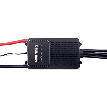
빠른 보기 ![12S 100A ESC for Aerial Survey Multirotor Aircraft | Makeflyeasy]()

빠른 보기 ![MakeflyeasyMakeflyeasy Aerial Survey High Efficiency Electrical Factory Custom ReUAVMODEL]()
![MakeflyeasyMakeflyeasy Aerial Survey High Efficiency Electrical Factory Custom ReUAVMODEL]()
![MakeflyeasyMakeflyeasy Aerial Survey High Efficiency Electrical Factory Custom ReUAVMODEL]()

빠른 보기 ![Believer Aerial Survey Carrier Kit[MFE] Believer Aerial Survey Carrier Kit (EPO, EVA, Carbon Tube, ABS CUAVMODEL]()
![Believer Aerial Survey Carrier Kit[MFE] Believer Aerial Survey Carrier Kit (EPO, EVA, Carbon Tube, ABS CUAVMODEL]()
![Believer Aerial Survey Carrier Kit[MFE] Believer Aerial Survey Carrier Kit (EPO, EVA, Carbon Tube, ABS CUAVMODEL]()
![Believer Aerial Survey Carrier Kit[MFE] Believer Aerial Survey Carrier Kit (EPO, EVA, Carbon Tube, ABS CUAVMODEL](//www.uavmodel.com/cdn/shop/files/1_2e79ca30-9144-4132-bf81-fa7f19eff551.jpg?v=1761901798&width=20)
빠른 보기 
PixSurvey A2 Aerial Survey Autopilot Kit
더 읽기PixSurvey A2 Aerial Survey Autopilot Kit: Revolutionizing UAV Surveying for Professionals Introduction to the PixSurvey A2 Autopilot Kit In the world of unmanned aerial systems (UAS), the need for precise,...

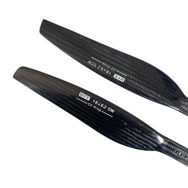
빠른 보기 ![Makeflyeasy Carbon fiberMakeflyeasy Carbon fiber composite propeller 1862 dynamic balance caliUAVMODEL]()
![Makeflyeasy Carbon fiberMakeflyeasy Carbon fiber composite propeller 1862 dynamic balance caliUAVMODEL]()
![Makeflyeasy Carbon fiberMakeflyeasy Carbon fiber composite propeller 1862 dynamic balance caliUAVMODEL]()

빠른 보기 ![Makeflyeasy UAVMakeflyeasy UAV aerial survey PIXHAWK camera shutter cableUAVMODEL]()

빠른 보기 ![Makeflyeasy Pioneer Aerial Survey Aircraft Kit Small Parts]()
![Makeflyeasy Pioneer Aerial Survey Aircraft Kit Small Parts]()
![Makeflyeasy Pioneer Aerial Survey Aircraft Kit Small Parts]()

빠른 보기 
AirBrain A3PRO — Dedicated Flight Control System for Aerial Survey & AOPA Training
더 읽기AirBrain A3PRO — Dedicated Flight Control System for Aerial Survey & AOPA Training Professional flight controller for aerial survey, photogrammetry, and pilot training — industrial grade, multi-sensor redundancy, cross-wrap flight...
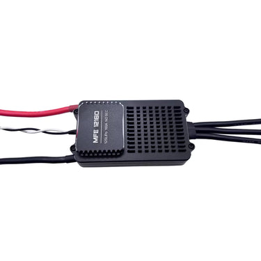
![Makeflyeasy 12S 160A ESC for aerial surveying and cruising For PIONNER only]()
![Makeflyeasy 12S 160A ESC for aerial surveying and cruising For PIONNER only]()
![Makeflyeasy 12S 160A ESC for aerial surveying and cruising For PIONNER only]()

빠른 보기 Skywalker X8 2122mm UAV Fixed Wing Drone: The Ultimate Long-Range FPV and Survey Platform
더 읽기Skywalker X8 2122mm UAV Fixed Wing Drone: The Ultimate Long-Range FPV and Survey Platform In the rapidly evolving world of unmanned aerial vehicles, fixed-wing drones continue to dominate long-range and...

Why Fixed Wing Drones Are the Best Choice for Long-Range Aerial Surveys in the USA?
더 읽기Across industries like agriculture, mining, energy, and infrastructure, the demand for accurate and cost-effective aerial surveys is growing quickly. From massive farmlands in the Midwest to sprawling oil pipelines in...
![Makeflyeasy Hero MonitoringMakeflyeasy Hero Monitoring Aerial Survey Carrier KIT (EPO, EVA, CarboUAVMODEL]()
![Makeflyeasy Hero MonitoringMakeflyeasy Hero Monitoring Aerial Survey Carrier KIT (EPO, EVA, CarboUAVMODEL]()
![Makeflyeasy Hero MonitoringMakeflyeasy Hero Monitoring Aerial Survey Carrier KIT (EPO, EVA, CarboUAVMODEL]()

빠른 보기 Unmanned Aerial Vehicle (UAV) Technology: A Comprehensive Guide
더 읽기Unmanned Aerial Vehicle (UAV) Technology: A Comprehensive Guide Unmanned Aerial Vehicles (UAVs), commonly known as drones, represent one of the fastest growing sectors in modern aerospace technology. From hobby grade...

무인 항공기 매핑: 용도 및 장점
더 읽기UAV 드론 매핑은 어떻게 활용되나요? 점점 더 많은 건설 현장들이 속도, 품질 및 효율성을 높이기 위해 드론 매핑을 도입하고 있습니다. 보도에 따르면얼라이드 마켓 리서치, 건설 드론 산업은 2027년까지 약 120억...
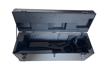
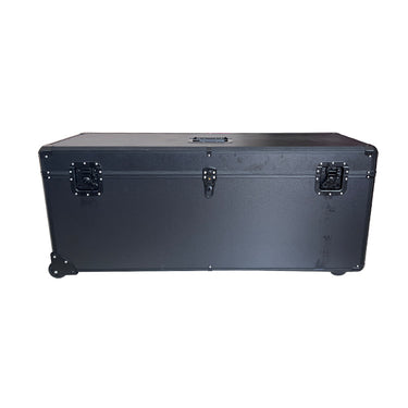
![HERO Aerial Survey DroneMakeflyeasy HERO Aerial Survey Drone Transport Case Portable Case OtheUAVMODEL]()
![HERO Aerial Survey DroneMakeflyeasy HERO Aerial Survey Drone Transport Case Portable Case OtheUAVMODEL]()
![HERO Aerial Survey DroneMakeflyeasy HERO Aerial Survey Drone Transport Case Portable Case OtheUAVMODEL]()

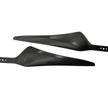
빠른 보기 ![Makeflyeasy 17*55 carbon fiber propellerMakeflyeasy 17*55 1755 Carbon Fiber Propeller Aerial Survey UAV ForwarUAVMODEL]()
![Makeflyeasy 17*55 carbon fiber propellerMakeflyeasy 17*55 1755 Carbon Fiber Propeller Aerial Survey UAV ForwarUAVMODEL]()

빠른 보기 ![Makeflyeasy Aerial surveyMakeflyeasy Aerial survey high-efficiency motor Customized Struggler VUAVMODEL]()

빠른 보기 ![Makeflyeasy Aerial surveyMakeflyeasy Aerial survey high efficiency motor Struggler VTOL rotor mUAVMODEL]()
![Makeflyeasy Aerial surveyMakeflyeasy Aerial survey high efficiency motor Struggler VTOL rotor mUAVMODEL]()
![Makeflyeasy Aerial surveyMakeflyeasy Aerial survey high efficiency motor Struggler VTOL rotor mUAVMODEL]()

빠른 보기 
측량 및 지도 작성 드론, DeepSeek과 손잡고: 측량 및 지도 작성의 새로운 시대를 열다
더 읽기조사 및 측량 드론, DeepSeek과 손잡다: 조사 및 측량의 새로운 시대를 열다 오늘날 급속한 기술 발전의 시대에 측량 및 지도 제작 산업은 깊은 변화를 겪고 있습니다. 효율적이고 유연한 측량 및...

How UAV Fixed Wing Drones Are Transforming Land Surveying and GIS Mapping?
더 읽기Large or linear projects, think highways, rail corridors, transmission lines, pipelines, coastal zones, demand faster coverage and consistent accuracy across big distances. A fixed wing UAV answers that need by...


![Believer Aerial Survey Carrier Kit[MFE] Believer Aerial Survey Carrier Kit (EPO, EVA, Carbon Tube, ABS CUAVMODEL](http://www.uavmodel.com/cdn/shop/files/2_cd469d79-3577-4867-b2d9-a84659f76a2d.jpg?v=1761901798&width=375)
![Believer Aerial Survey Carrier Kit[MFE] Believer Aerial Survey Carrier Kit (EPO, EVA, Carbon Tube, ABS CUAVMODEL](http://www.uavmodel.com/cdn/shop/files/3_3919a81b-097c-4d5a-858a-5159f0c2ce95.jpg?v=1761901797&width=375)
![Believer Aerial Survey Carrier Kit[MFE] Believer Aerial Survey Carrier Kit (EPO, EVA, Carbon Tube, ABS CUAVMODEL](http://www.uavmodel.com/cdn/shop/files/4_b8948031-e19f-476c-be58-45b9df8defb2.jpg?v=1761901797&width=375)
![Believer Aerial Survey Carrier Kit[MFE] Believer Aerial Survey Carrier Kit (EPO, EVA, Carbon Tube, ABS CUAVMODEL](http://www.uavmodel.com/cdn/shop/files/1_2e79ca30-9144-4132-bf81-fa7f19eff551.jpg?v=1761901798&width=20)